whose ford?
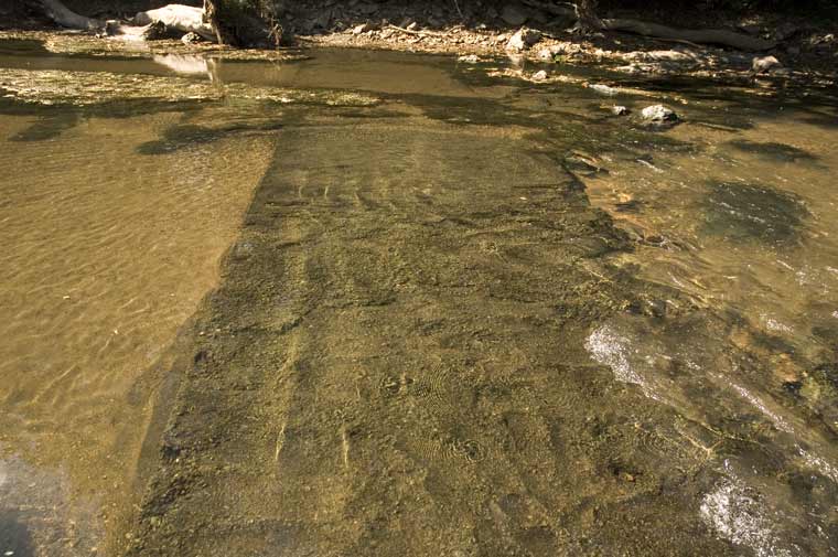
What is nine feet wide, 160 feet long, made of a stone aggregate, and runs beneath the surface of the Rivanna?
A road?
But consider, before the breach of the Woolen Mills dam, this now visible slab was flooded, covered continuously by several feet of water.
Portland cement was patented in 1824. So assuming this is a Portland aggregate slab, when and why was it put in place? If it was built after 1870 it could be described as a ford. Is the slab a continuous pour? Was it built in place or in sections that were dragged into the river?
Help!!!
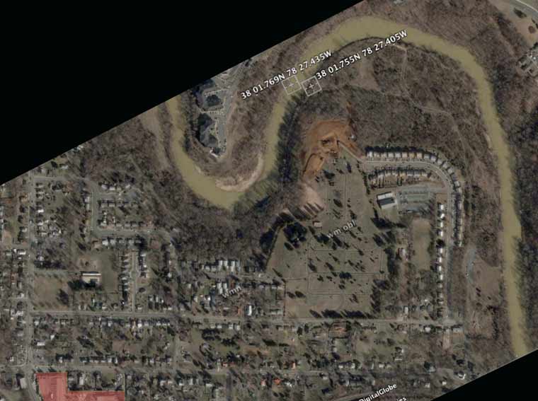
The location of the slab is marked on the Google Earth map above...
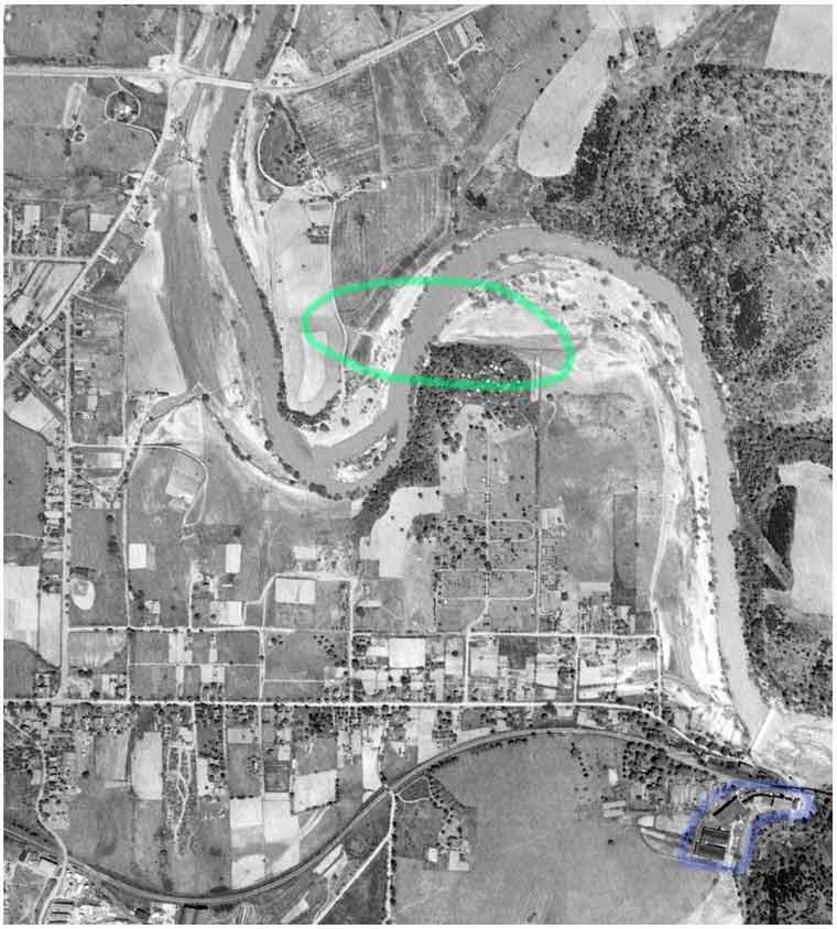
In this 1937 aerial view of the Woolen Mills the approximate location of slab is circled with green.
Memo to Vice-Mayor Hamilton: the Woolen Mills factory campus is outlined with purple in the lower right corner of this photo. Note the agrarian character of the residential Woolen Mills neighborhood bounded on the south by the railroad tracks and on the east and north by the Rivanna River.
Image kindness of the University of Virginia. Charlottesville & Albemarle Orthophotography. Retrieved 7/9/07, from the University of Virginia, Geospatial and Statistical Data Center: http://fisher.lib.virginia.edu/collections/maps/aerials/aerialindex.
Labels: Rivanna River
posted by emory at
3:24 PM
![]()

2 Comments:
Fascinating. It isn't Secretary's Ford, that's at the intersection of the train tracks and I-64 over the Rivanna. I have often wondered if there were any Native American dams in the area for the purposes of fishing (and strongly suspected that one created the foundation for our now-deceased dam), but those are generally piled stones, they didn't have concrete. Of course, they didn't have horses or an alphabet either, so they may have picked that up. For it to be useful, it would have to predate the dam, meaning older than 1790. Perhaps it was military infrastructure? I'd love to carbon date the thing.
On second thought, maybe it is Secretary's Ford. I was pretty sure that that lay on the Three Notch'd Road, which went along the railroad tracks until it jumped through Downtown Charlottesville. But I could be wrong, and that's the only thing I know of in the area that's older than the dam. It did seem strange to me that Secretary's Ford would cross the Rivanna, and then cross Moore's Creek. This location would simplify the crossing enormously.
This would explain why Secretary's Ford lost its prominence in the neighborhood. It drowned.
Post a Comment
<< Home