mapping memory, mapping intent
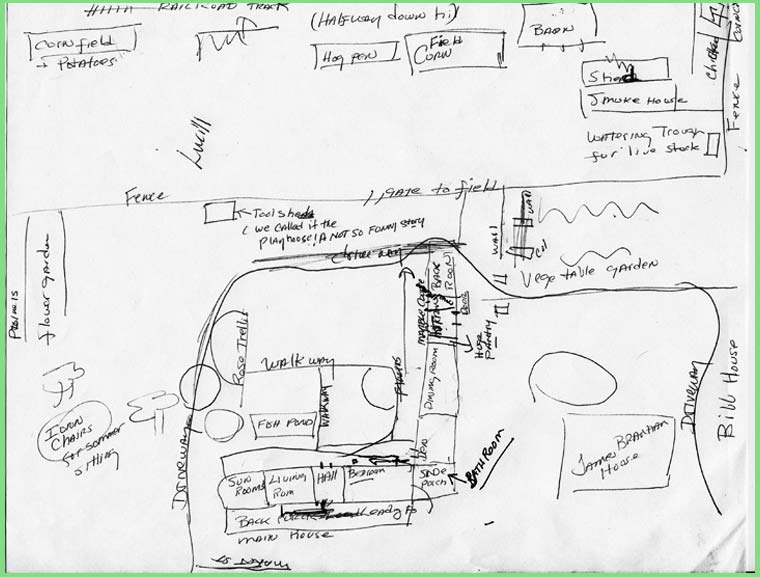
The map above created by James Branhams grand-daughter, Dorothy.
Woolen Mills Road (Market Street) is at the bottom of the map, the C&O (CSX) railroad tracks are at the top of the map, her grand-fathers seven acre farm is in the middle.
In 1993, Charlottesville City Council placed a protective zoning overlay on this property. Click here to see maps.
Labels: Timberlake-Branham
posted by emory at
11:46 AM
![]()

0 Comments:
Post a Comment
<< Home